
The Project: Mining Bathymetry Survey
📍United States
The Challenge
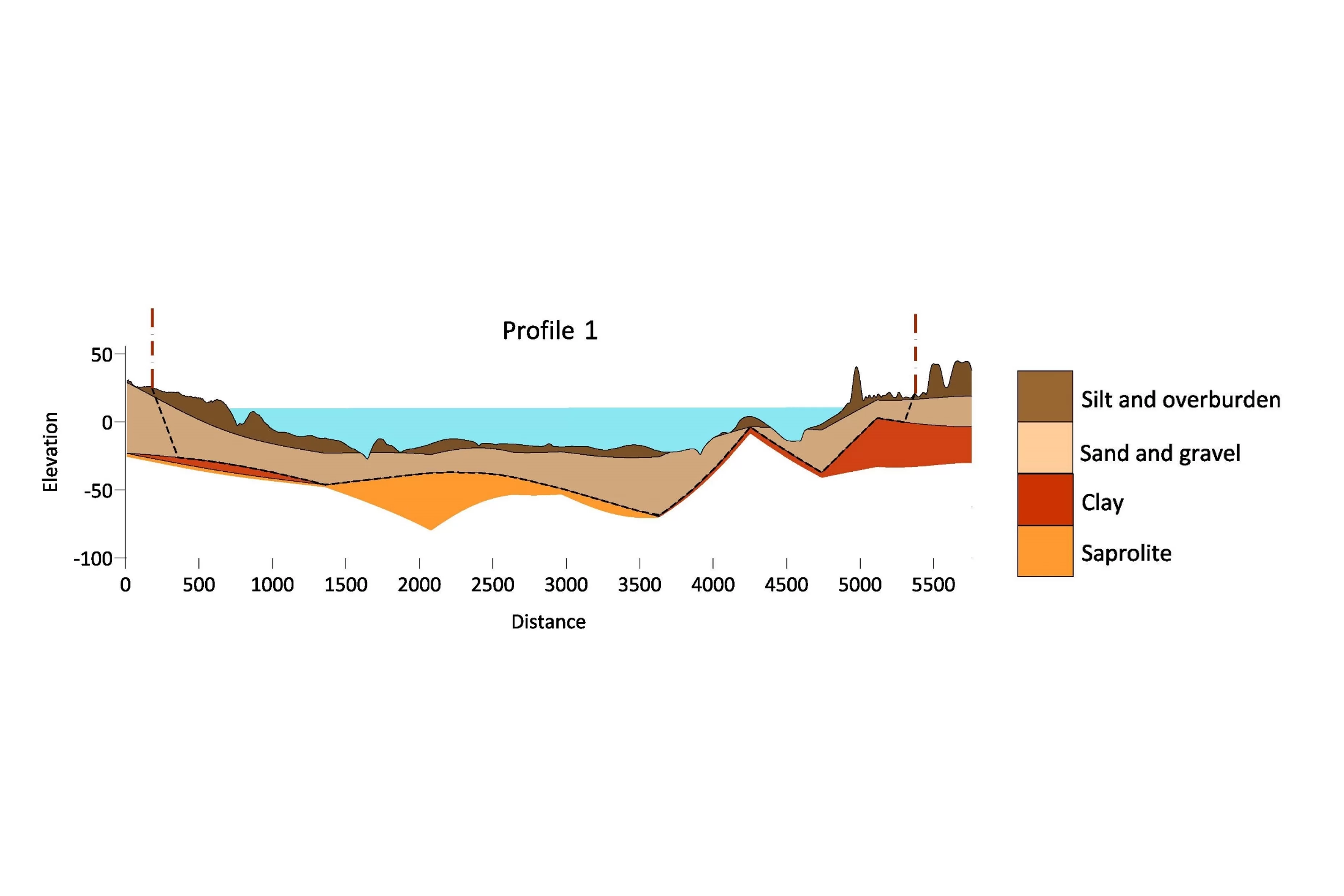
A mining client (company confidential) needed reserve estimates and permitted depth data to verify tonnage calculations, dredge operation, and permit compliance.
EARTHRES was selected to perform the survey after careful consideration of expertise and the ability to perform underwater and above ground surveys. Requiring both bathymetric and ground survey to multiple locations at a single site, this project was complex and diverse, requiring a company well versed in performing underwater and above ground surveys. The final product of the project required combining data from underwater and above ground surveys to allow accurate volume calculations and verify compliance with above and below water permit restrictions.
The Solution
Always ready and willing to implement the latest technology to provide high-quality work products to save the client time and money, EARTHRES reviewed options for completing the project and determined that a combination of drone aerial survey, traditional ground survey, and single beam sonar bathymetry would be the most economical and time-conscious approach.

In addition to providing the required maps and volumes, EARTHRES mining engineers and surveyors were able to use the collected data to help the client increase production without significant capital expenditures. The diversity of experience and knowledge of the EARTHRES team made this project a success for the client.
The Results
The client now has a clear understanding of their available resources within the established limits of mining. This understanding allows them to plan a method and rate of extraction to maximize profitability.