
![]()
At EARTHRES, we routinely provide the following hydrogeologic services for the successful development of our client’s projects:
![]()
── Analysis and Assessments
- Hydrogeologic Investigations, Mapping, and Assessment
- Water Supply Permitting and Resource Development
- Aquifer Assessments
- Source Water Assessment
- Contaminant Fate and Transport
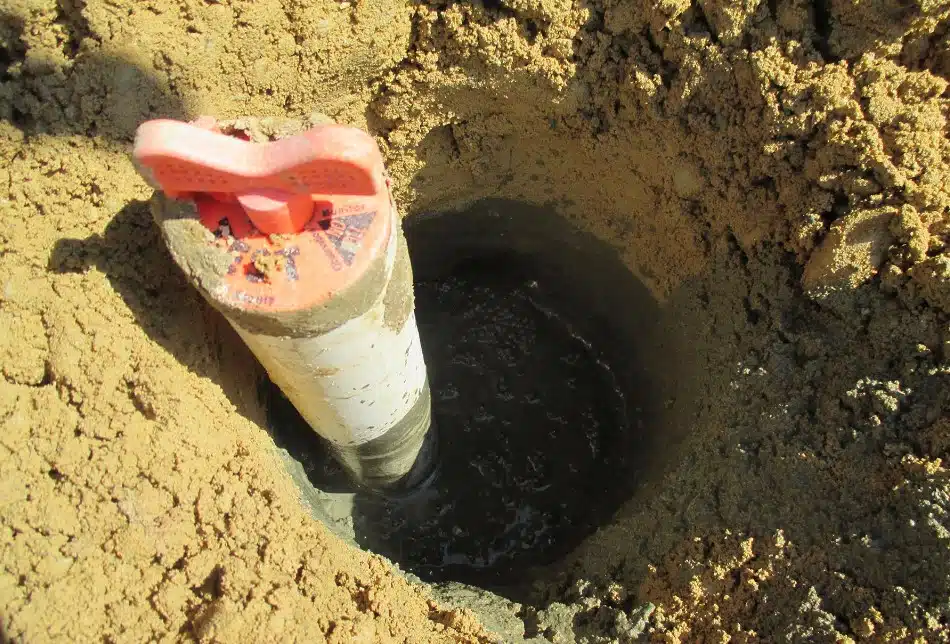
- Groundwater Sampling and Monitoring
- Wetland Hydrology Evaluation
- Database Development and Statistical Data Analysis
![]()
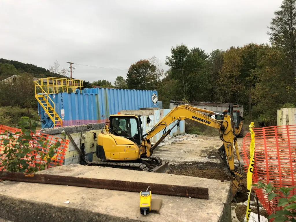
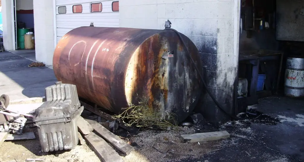
Before and during the development of a site, you may be required to conduct an environmental investigation and remediation if there are environmental impacts to soil, water, or air.
![]()
These impacts could be due to historical use of hazardous materials at the site or nearby sites. From offering services ranging from Phase I Environmental Site Assessments (ESA) to remediation, our talented team at EARTHRES will complete investigation(s) tailored to your plans for the site, and often in a phased manner to control costs. During this process, we will provide and communicate strategic remediation recommendations for the successful development of your project. Whether it is surface water, groundwater, soil, or vapor, we will evaluate the extent of existing or probability of potential IMPACTS using the latest techniques, models, and analytical methods.
![]()
In addition, and when required, we partner with you to develop and negotiate work plans for the U.S. EPA and PADEP and then implement those work plans to your satisfaction. Through proper design, planning, and implementation, we can turn your vision into reality.
![]()
── Investigation and remediation services include:
- Phase I and II Environmental Site Assessments (ESA) to ASTM AAI Standards
- Brownfields Investigations
- Pennsylvania Act 2 investigation and reporting
- Site characterization
- Pilot testing, remedial alternatives analysis, selection, and design
- Remediation and post-closure monitoring programs
- Clean fill / regulated fill evaluations
- Industrial facility decommissioning planning and CQA
- Litigation support
- Wetlands and ecological studies
- UST, AST and bulk storage facility closure investigations and reporting
- RCRA and CERCLA investigations
![]()
At EARTHRES, we turn your vision into reality by utilizing our collective experience in the sciences and engineering. We will advise what additional investigation, mitigation or other remediation services are warranted for the successful development of your project.
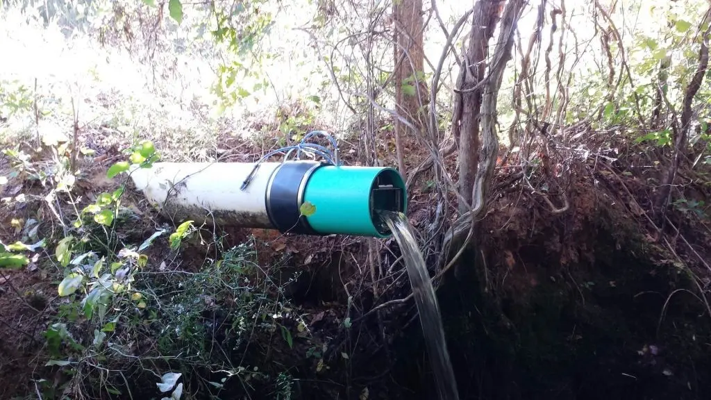
Maintaining the integrity of our water supply is challenging to say the least. A continual intricate balance of surface water, groundwater, climate change, droughts and in many times, strict regulations governing the conservation of this precious resource, can seem in direct competition with corporate initiatives.
![]()
EARTHRES hydrogeologists and geologists keep the water supply in mind when designing and this keeps water usage and wastewater to a minimum. We make certain your manufacturing process will see favorable reductions in operating costs, while still keeping in compliance with federal regulations that protect our natural water resources.
![]()
We offer a full range of hydrogeologic and environmental services that can help meet your long-term goals while respecting the water supply.
![]()
── Hydrogeologic Services
From well siting to complex groundwater and surface water modeling, EARTHRES will assist you with our extensive hydrogeologic services:
- Aquifer Testing
- Groundwater Modeling
- Water Sourcing and Permitting
- Water Supply Development
- Water Supply Permitting
- Water Treatment
- Wastewater Treatment
── Process Control Engineering
- Process Control Engineering
- Water/Wastewater Engineering
- Process Control/Instrumentation
── Wetland Services
Our team can assist you with determining if wetlands are present and provide valuable input on how to manage these areas while maximizing site usage and advancing your project to completion.
- Wetland/Waterway
Let our talented team provide the innovative approach your project requires to get it permitted and realized while preserving local and regional aquifer water supply.
![]()
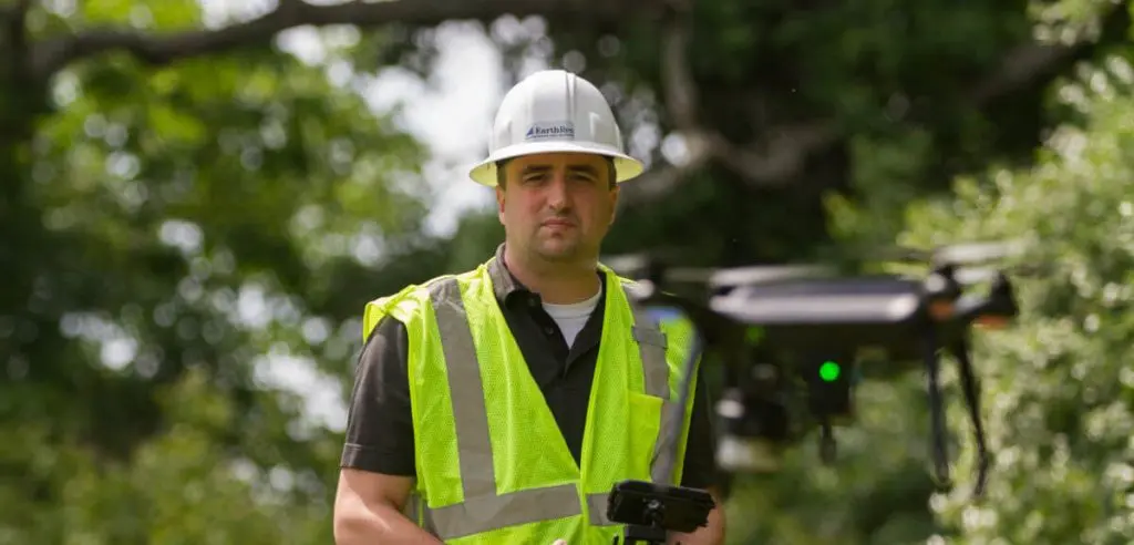
Our geophysical services experts will help you get a comprehensive look at your site by using techniques especially suited for your site and project needs. Our team of experts can help you get a first look at subsurface conditions before undertaking costly drilling or digging activities. Geophysical surveys can be paired with existing site data to reduce costs and optimize project results. Whether you’re looking for where to drill a new well or identify areas to avoid, or if you need to fully characterize subsurface conditions, EARTHRES will help you get the full picture for your project’s needs. If there are risks discovered, EARTHRES will be there to provide recommendations for remedial alternatives.
![]()
Invest in the EARTHRES team for your geophysical needs.
![]()
![]()
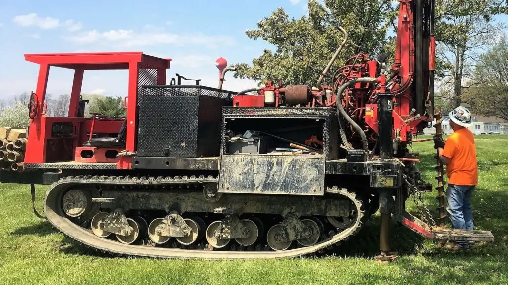
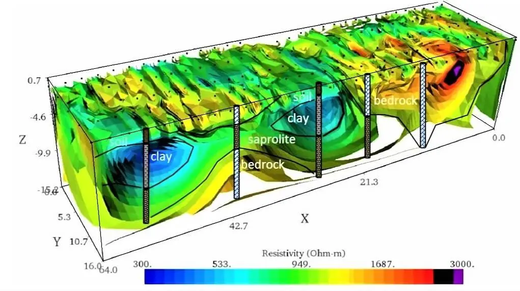
EARTHRES engineers and geoscientists routinely perform surveys to assess near-surface geologic and geotechnical site characteristics. Our team is trained in advanced non-invasive technologies like seismic surveys, electrical resistivity imaging, ground penetrating radar, magnetometer surveys, and 3D imaging techniques. These tools allow us to assess subsurface conditions at your project site and characterize key features like depth to bedrock, depth to water, pinnacled bedrock, sinkholes and other karst features, soil and groundwater contamination, buried waste, water-producing zones, mineral deposits, buried drums, or other anthropogenic artifacts beneath the surface.
![]()
From karst and geotechnical investigations to environmental remediation and water supply projects, EARTHRES can assist with your project’s investigation requirements, and help you see it through to completion.
![]()
── EARTHRES’ Geophysical Methods
- Electrical Resistivity
- Ground Conductivity
- Seismic Refraction
- Seismic Reflection
- MASW
- Ground Penetrating Radar
- Borehole Geophysics
- Magnetometer Surveys
── EARTHRES’ Geophysical Services
Our geophysical services include:
- 3D Imaging
- Production Well Siting
- Sinkhole/Karst Investigations
- Geotechnical Investigation
- UST and Drum Location
- Waste Pit and Landfill Mapping
- Depth to Bedrock Surveys
- IBC Seismic site classification
- Rippability Evaluations
- Fracture Delineation
- Hydrogeological Field Investigations
![]()
If your next project requires geophysical services, turn to our team. EARTHRES is uniquely equipped with the expertise and experience to reach success at each stage of your project.
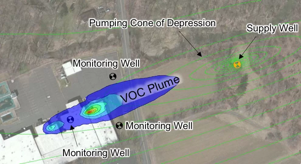
The EARTHRES team uses proven modeling techniques, combined with sound hydrogeological principles to satisfy your project goals and regulatory requirements.
![]()
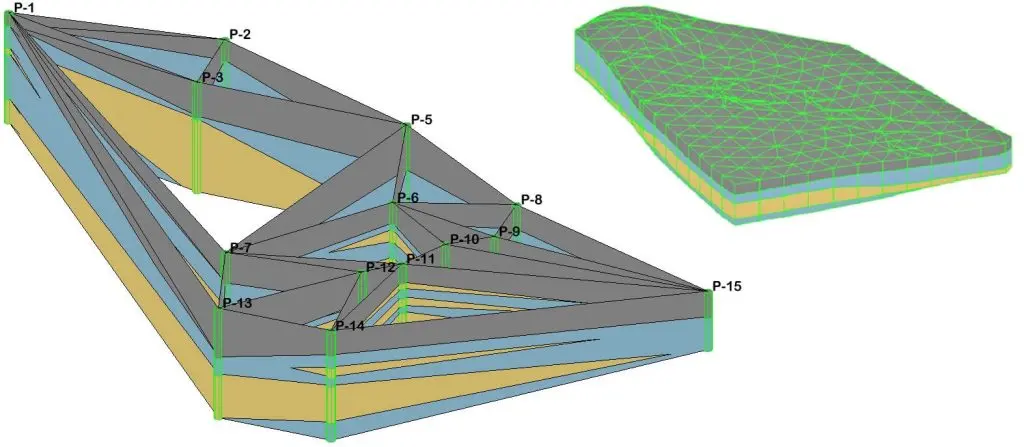
The approach is practical, cost-effective, and results-oriented, emphasizing real-world supporting data and observations. EARTHRES routinely performs groundwater modeling and other types of environmental modeling across multiple industries and market sectors. Our expertise in numerous types of groundwater models allows us to create the right model for your site, whether a simple analytical model or a sophisticated, 3-dimensional, numerical flow and contaminant transport model. Our experienced team members at EARTHRES offer a full range of hydrogeologic services and will collect the real-world data required for the creation and calibration of a model to suit your needs.
![]()
── Groundwater and environmental modeling may be utilized in any number of applications, including:
![]()
- Water Resource Management
- Groundwater Sustainability Studies
- Aquifer Characterization
- Karst Aquifer Characterization
- Contaminant Fate and Transport Analysis
- Mine & Construction Dewatering Analysis
- Remedial System Well Spacing & Capture Zone Determination
- Contaminated Site Closure
- Wastewater Discharge
- NPDES Discharge Evaluations
- Antidegradation Assessments
- Flooding and Ground Subsidence
- Mine and Construction Site Dewatering Analysis
- Superfund Site Management
- Saltwater Intrusion Impacts
- Litigation Support
![]()
── Groundwater and Environmental Modeling Services
![]()
- GMS MODFLOW
- MT3DMS, RT3D, PEST
- MODPATH Particle Tracking
- SEAWAT
- SESOIL
- PHREEQC
- QUICK DOMENICO
- WQM
- PENTOXSD
- PART/RORA/HYSEP
- SWLOAD
- BUFFER1
- BUSHECK ALCANTAR
- SWSTAT
![]()
EARTHRES is committed to helping our clients manage their water resources, mitigating potential liabilities and promoting sustainability while helping them achieve their project goals.
![]()
All product and company names are trademarks™ or registered® trademarks of their respective holders.
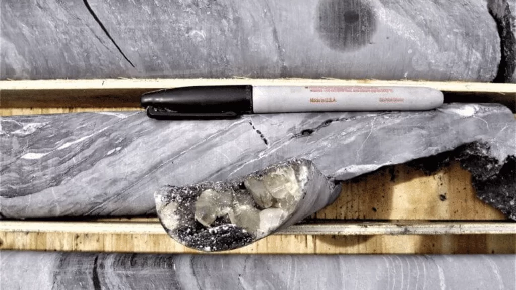
Our mineral evaluations include a thorough exploration and feasibility analysis outlining the risk and profit potential of your project.
![]()
Our team of professional mining engineers and geologists specialize in geology and mineral deposit evaluation. The team will develop a model outlining the quality and quantity of each of the minerals present in your deposit and help you determine the economic viability of extracting and processing your resources. Let our mineral evaluations help optimize your capital investment and minimize the risk of your venture.
![]()
Before beginning a new project, our team of specialists at EARTHRES will complete a full mineral evaluation.
![]()
── Exploration and Feasibility
![]()
- Geologic Assessment Sampling/Drilling
- Bench Testing
- Analytical and Application Testing
- Valuation of New Mineral Deposits and Existing Operations
- Market Assessments and Feasibility Studies
- Mining, Processing, and Marketing Expertise to Manage Costs
- Business Planning, Operations Management, and Strategic Planning
- Mergers and Acquisitions Due Diligence
- Technical Feasibility Studies (Lab, Pilot Applications Testing)
- Identifying New High-Value Mineral Products
- Strategies to Meet Customer Needs at the Lowest Possible Cost
── Applications
- Frac Sand
- Refractories
- Drilling Mud Additives
- Ceramics
- Cosmetics
- Coatings
- Adhesives
- Glass Sand (Standard and High Purity)
- Paper
- Plastics
- Rubber
- Concrete Additives
- Construction Aggregates
- Sand and Gravel
- Coal
- Industrial Minerals
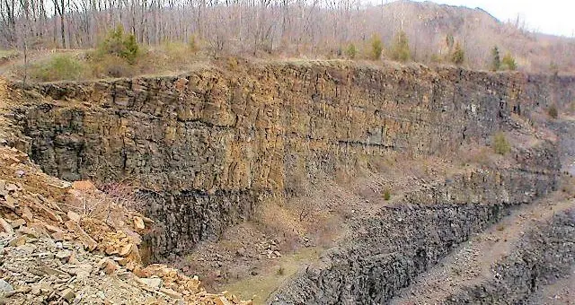
At EARTHRES, we routinely provide the following geologic services for the successful development of our clients’ projects:
![]()
- Geologic Investigations, Mapping, and Evaluation
- Exploration Drilling, Sampling, and Analysis
- Carbonate – Karst Geology Studies
- Borehole Geophysical Surveys
- Surficial Geophysical Surveys
- Geotechnical and Slope Stability Evaluations
- Fracture Trace Analysis
- Geologic Modeling
- Naturally Occurring Asbestos Assessments
── Support Services
![]()
- Environmental Site Assessment and Remediation
- Hydrogeologic and Groundwater Modeling Services
- Litigation Support
- Permitting, Monitoring, and Regulatory Compliance
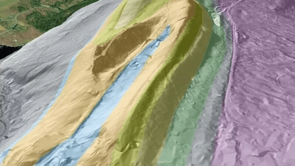
Determine site selection, route selection, evacuation planning, model mine construction, resource extraction and pipeline planning with our GIS services.
![]()
GIS Consulting
![]()
Using available geographic information system data (GIS) EARTHRES can help you evaluate and plan for future operations/expansions. EARTHRES can generate georeferenced maps using field collected data. These maps can be used for construction planning, record keeping, etc.
![]()
── Geographical Data
![]()
- Economic
- Social
- Zoning
- Environmental
- Geological
- Hydrogeological
- Civil Infrastructure
- Location
- Property
- Traffic
- Energy
- Field Data
── Modeling
![]()
- Demographics
- Hydrogeology
- Geology
- Resource and Asset Management
- Hazard Analysis
- Land Use
- Construction Management
- Property Management
- Infrastructure
── Mapping Technology
![]()
Using our GIS services, you will be able to view your facility with georeferenced data, allowing you to make faster, better-informed decisions. Contact us for cost-effective GIS mapping services to provide georeferenced data for comprehensive planning of your next project.